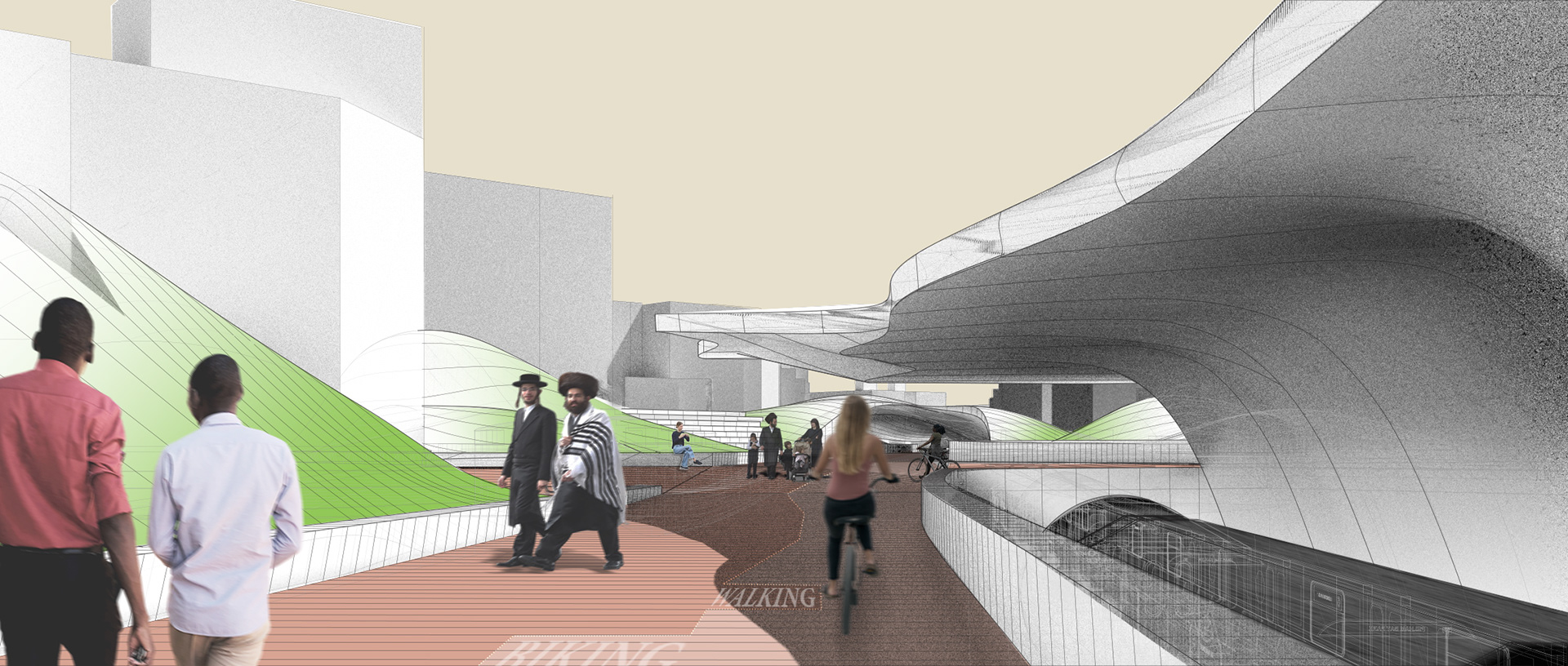
‘URBANeSCAPE’ is developed with the knowledge of not only creating a path suitable to the needs of the commuter and those looking for an active biking and walking space above, but also to sensitively cater the culture and history of the surrounding site and community.

Rail Line
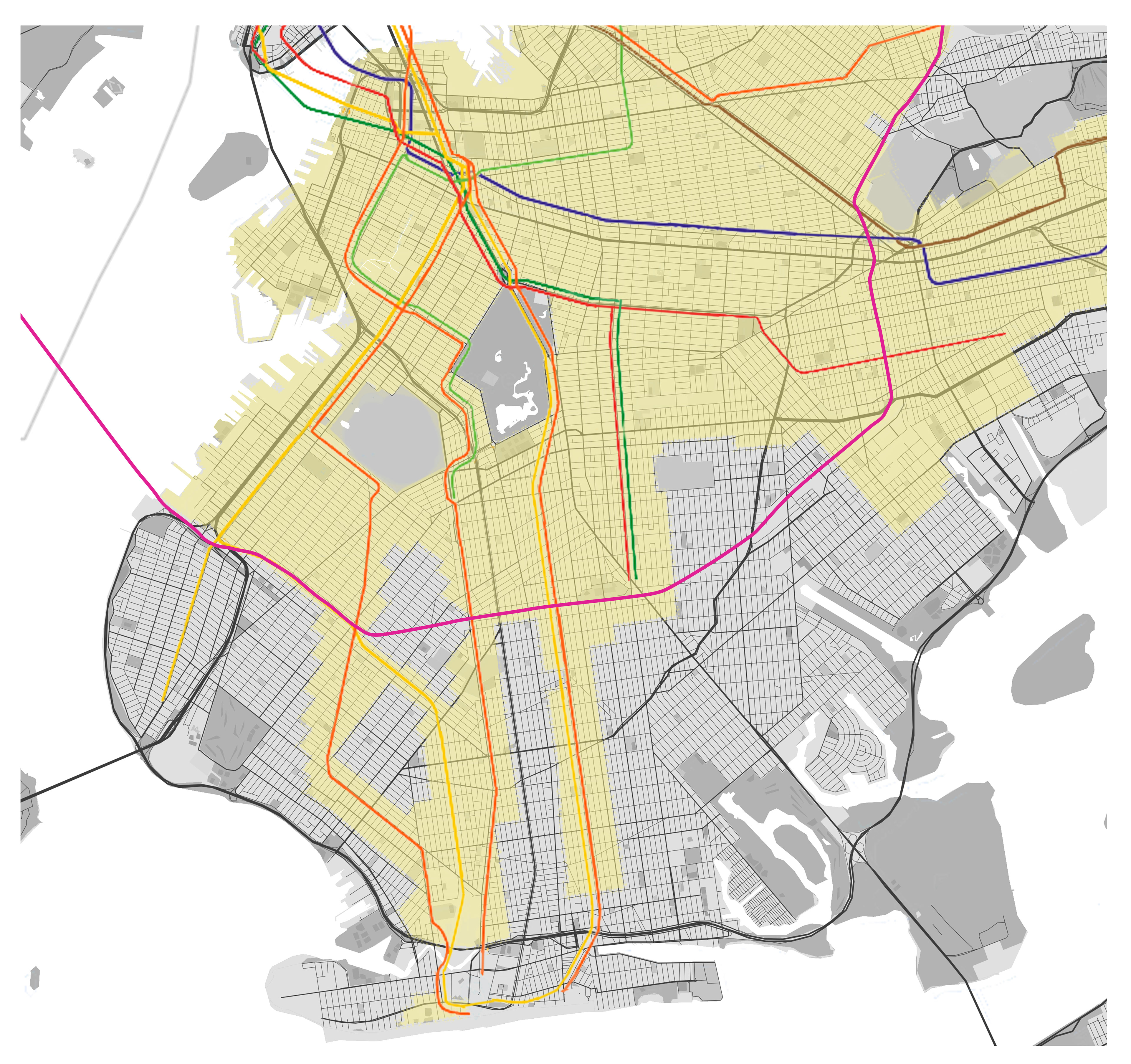
Subways and Transit Zone

Bike Lanes and Paths

Overlay with Focused Location
Location Analysis
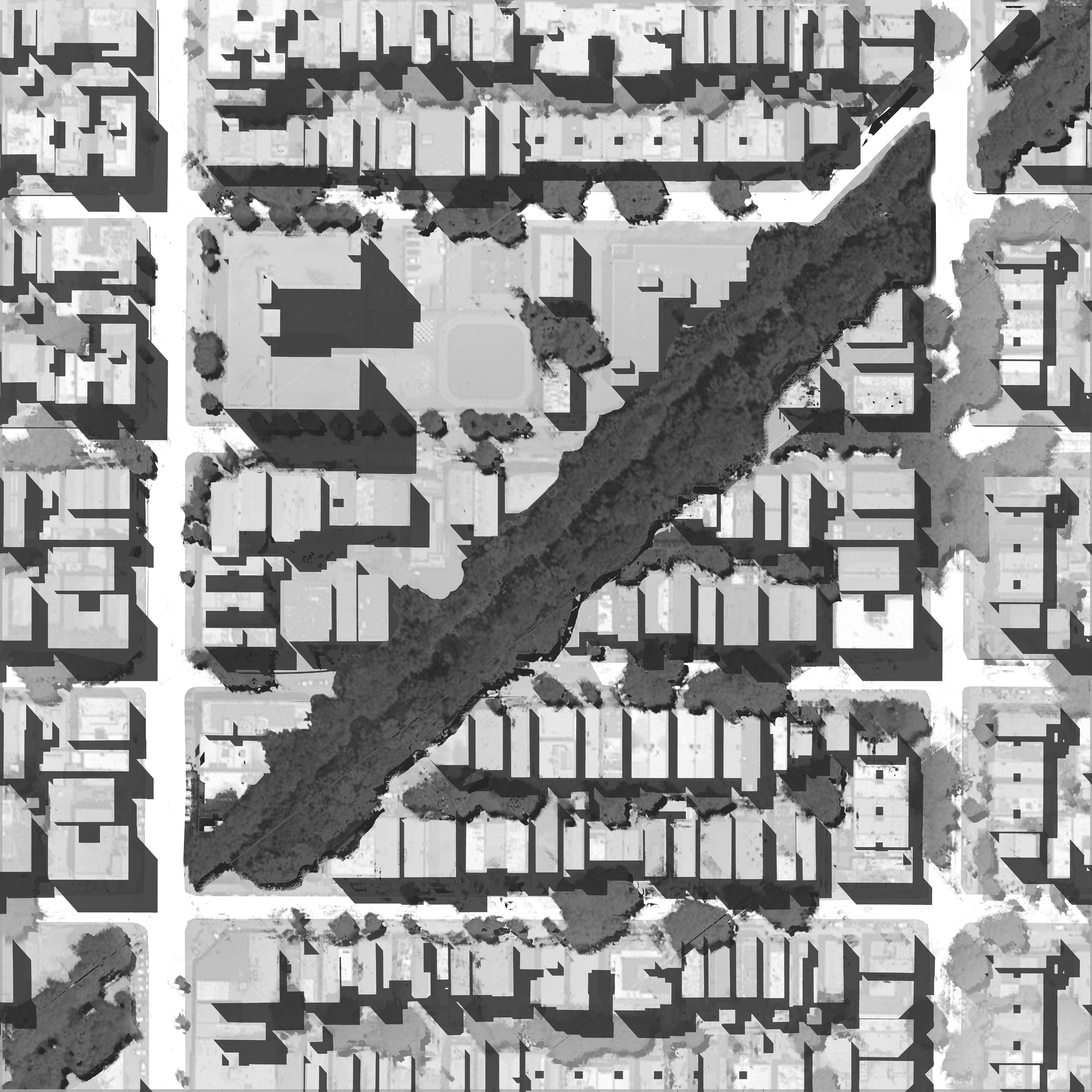
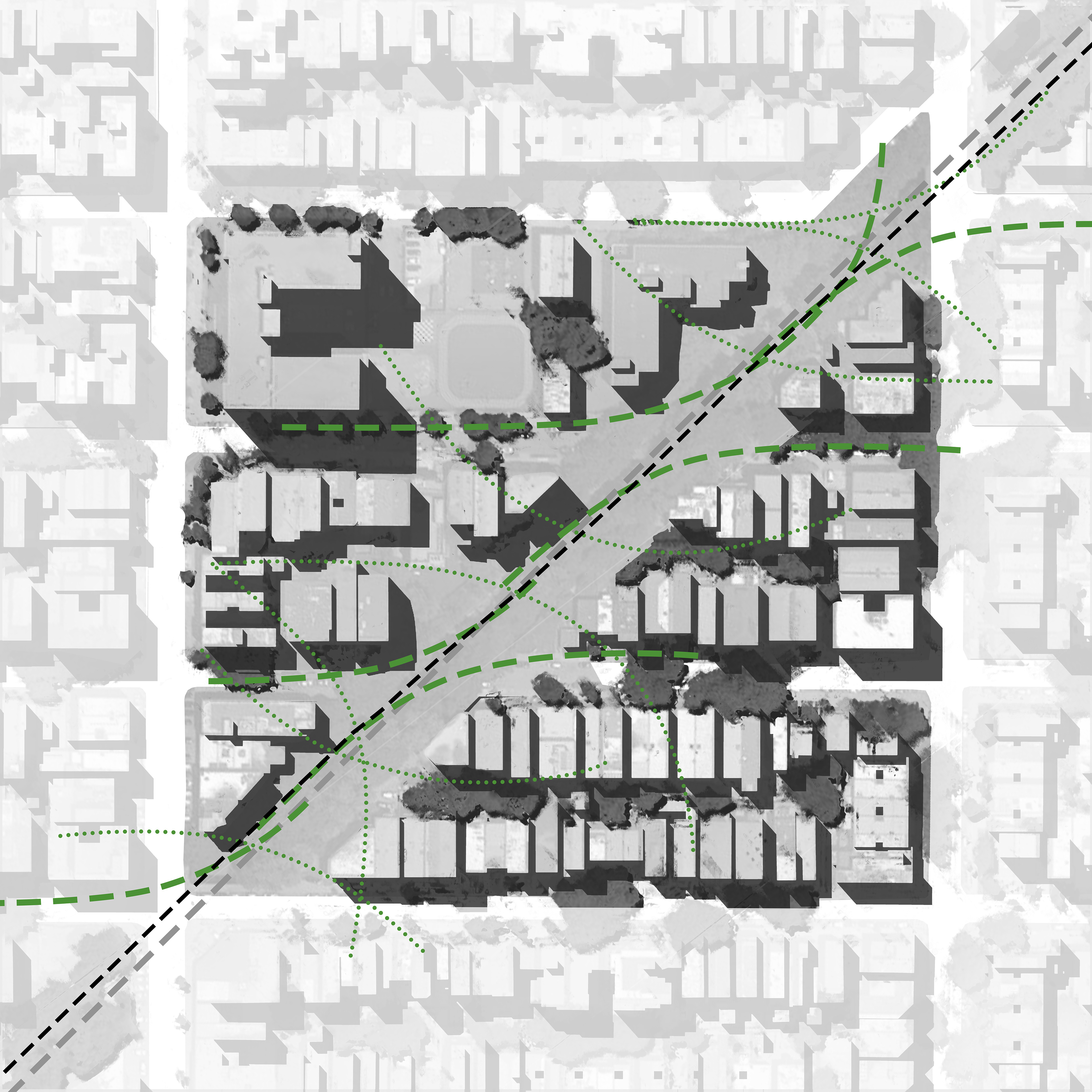
When choosing a location to start, across 25 miles of site, it was important to understand the exterior community factors that would play a role on the development. Through the eyes of a commuter, the rail system is a connection between existing rail lines that already dive down into Brooklyn, creating more accessibility to all that move New York. But for those looking for an active space above, the line could be a streamline movement area, opening up potential of biking and walking lanes.
Connecting to other pathways, this system could carry people above and below to new areas of the city that were not as easily attainable before. It became apparent that one particular area could be of interest. This area, which subtracted itself from the requirements of the transit zone in 2016, would be in a tougher position to make accommodations for this bike path.

Site Context Overlay
When taking a closer look, one begins to understand the heavy implications of developing in this area. The new subway line would carry itself along and through the neighborhood of Borough Park, home to the largest Orthodox Jewish group outside of Israel, and the largest concentration of Jewish in all of the United States.


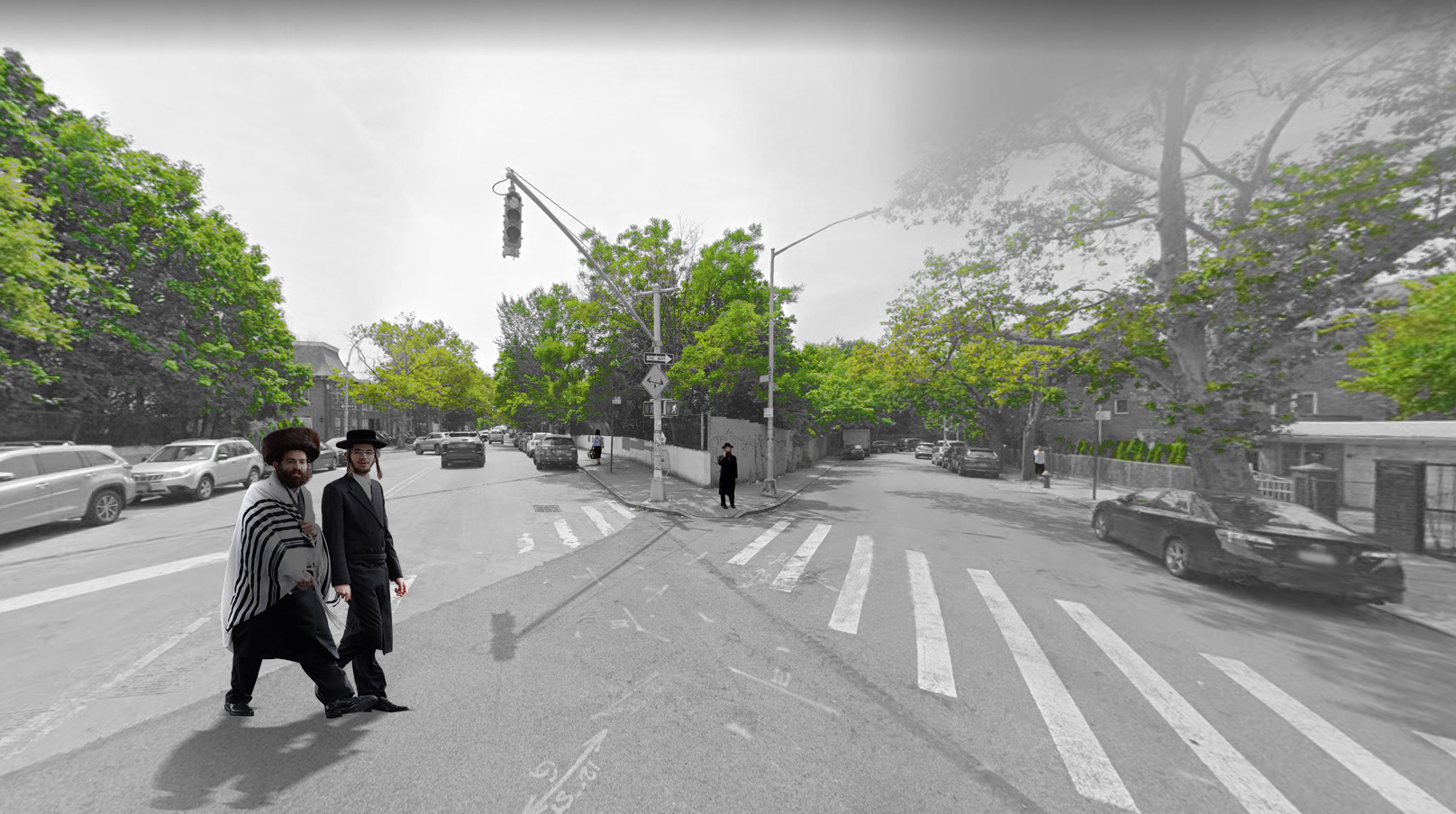
It was apparent that this was a community secluded from the rest of Brooklyn, an area made their own after years of cultivating traditions and followings. It was understood that the means of intervention must be developed with the knowledge of not only creating a path suitable to the needs of the common visitor, but also to sensitively cater the culture and history of the surrounding site.


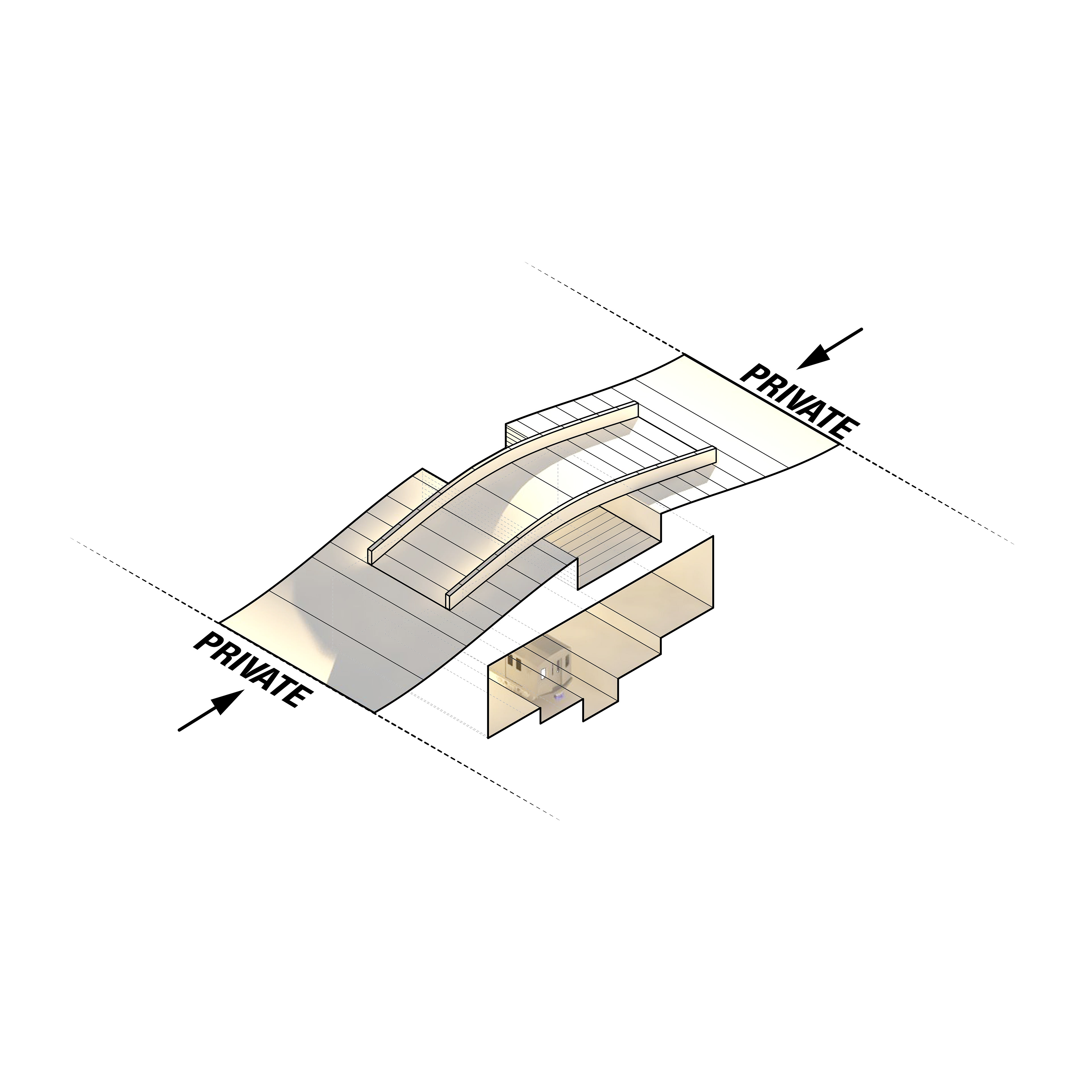
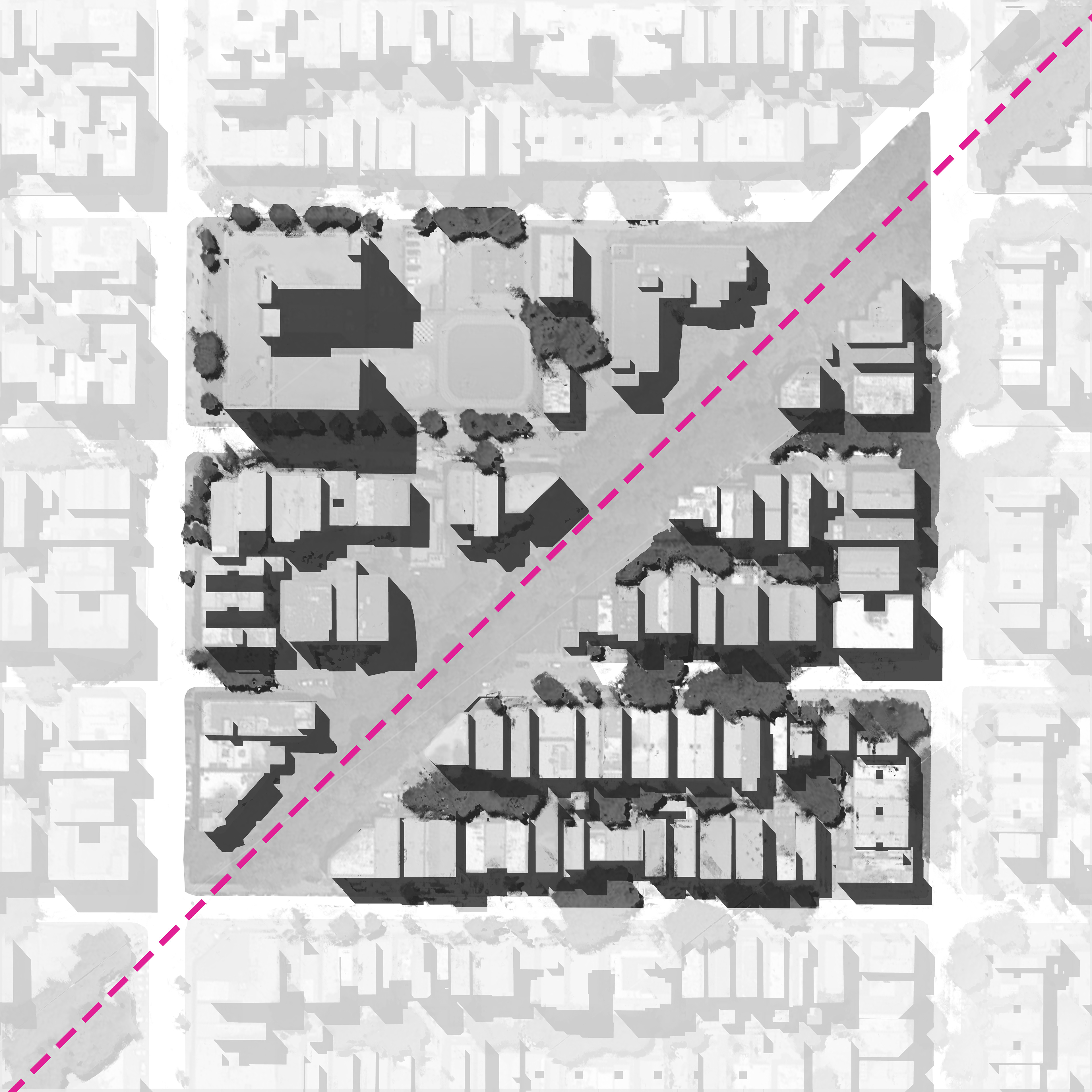
Site Carving Analysis
This area of opportunity lies in the space between the transit and the community, which would become a place of agreement between the private and public activities. In order to determine how the site’s conflicting program could work together, a series of studies was introduced.


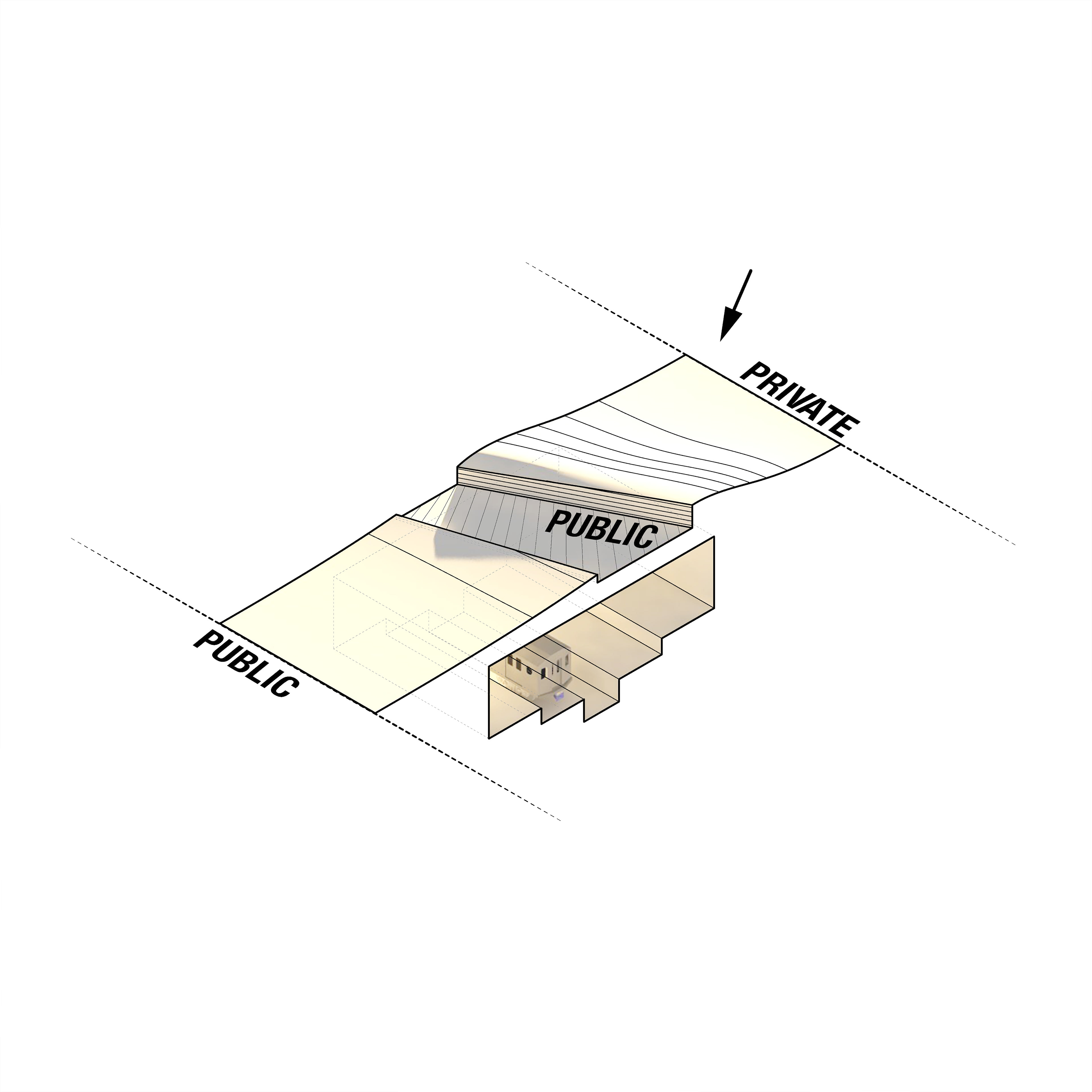
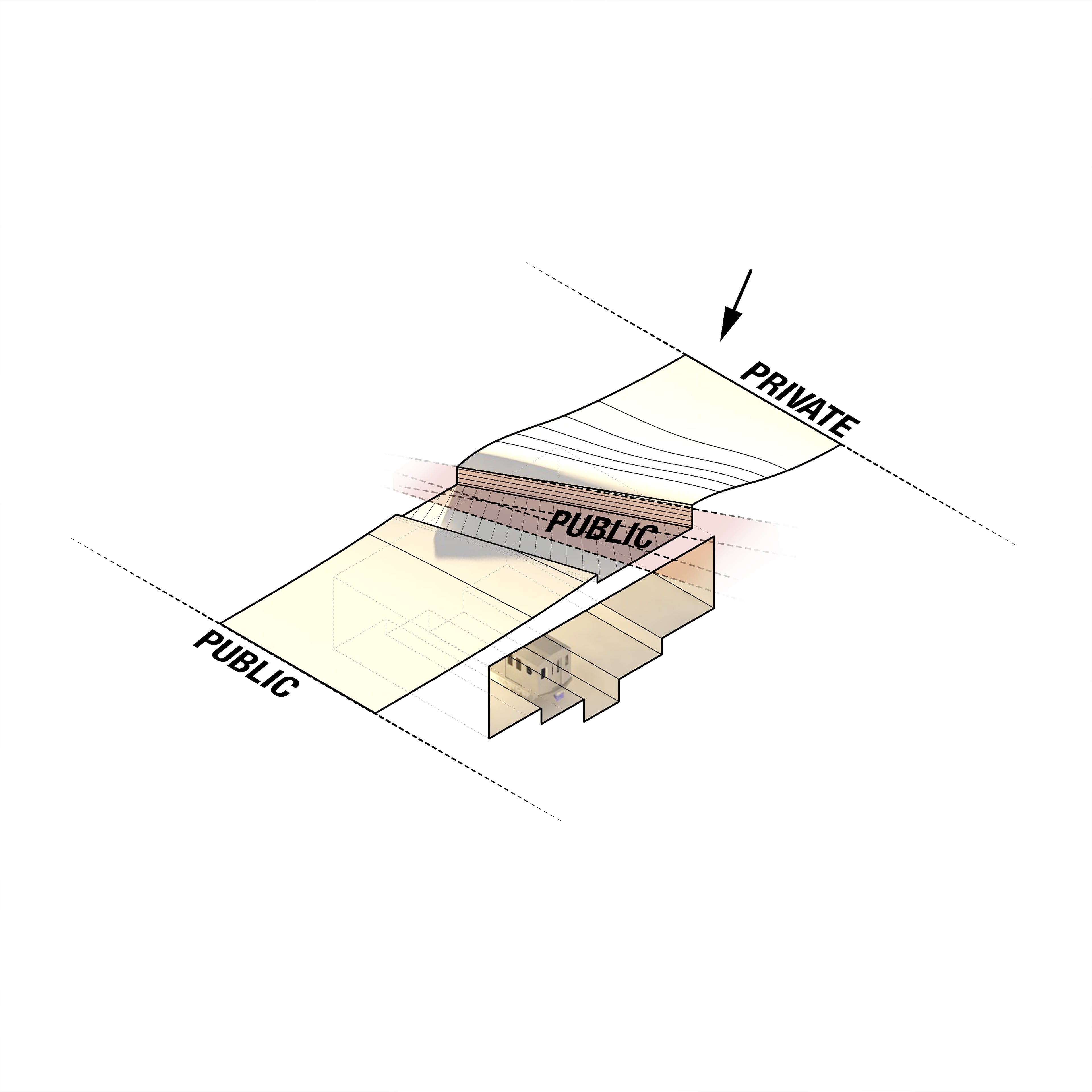
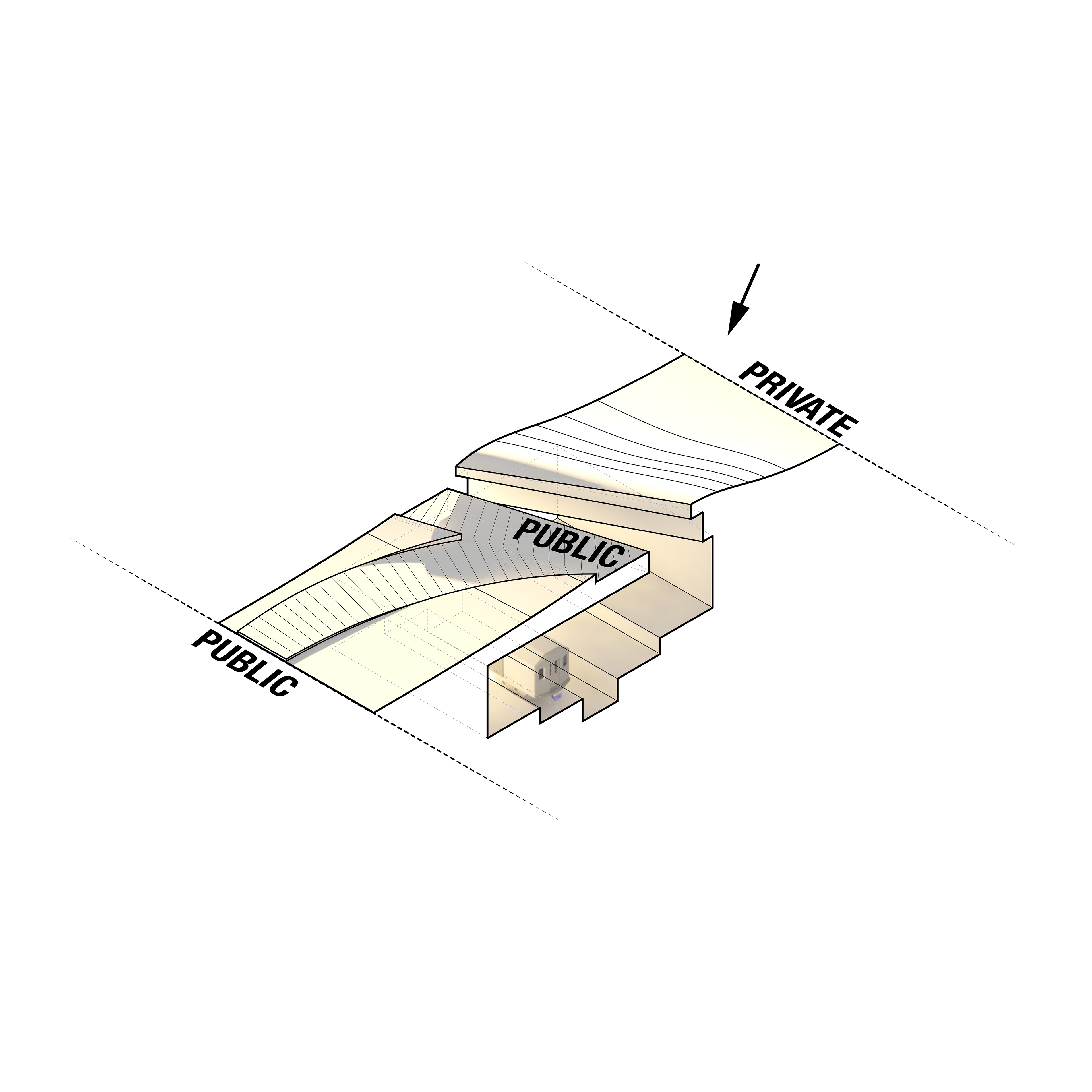
A rule set emerged from the land. When one folded, weaved, and pulled portions of the site, it would morph to the community and its private needs. Public amenities would then slice, cut, and split the site.


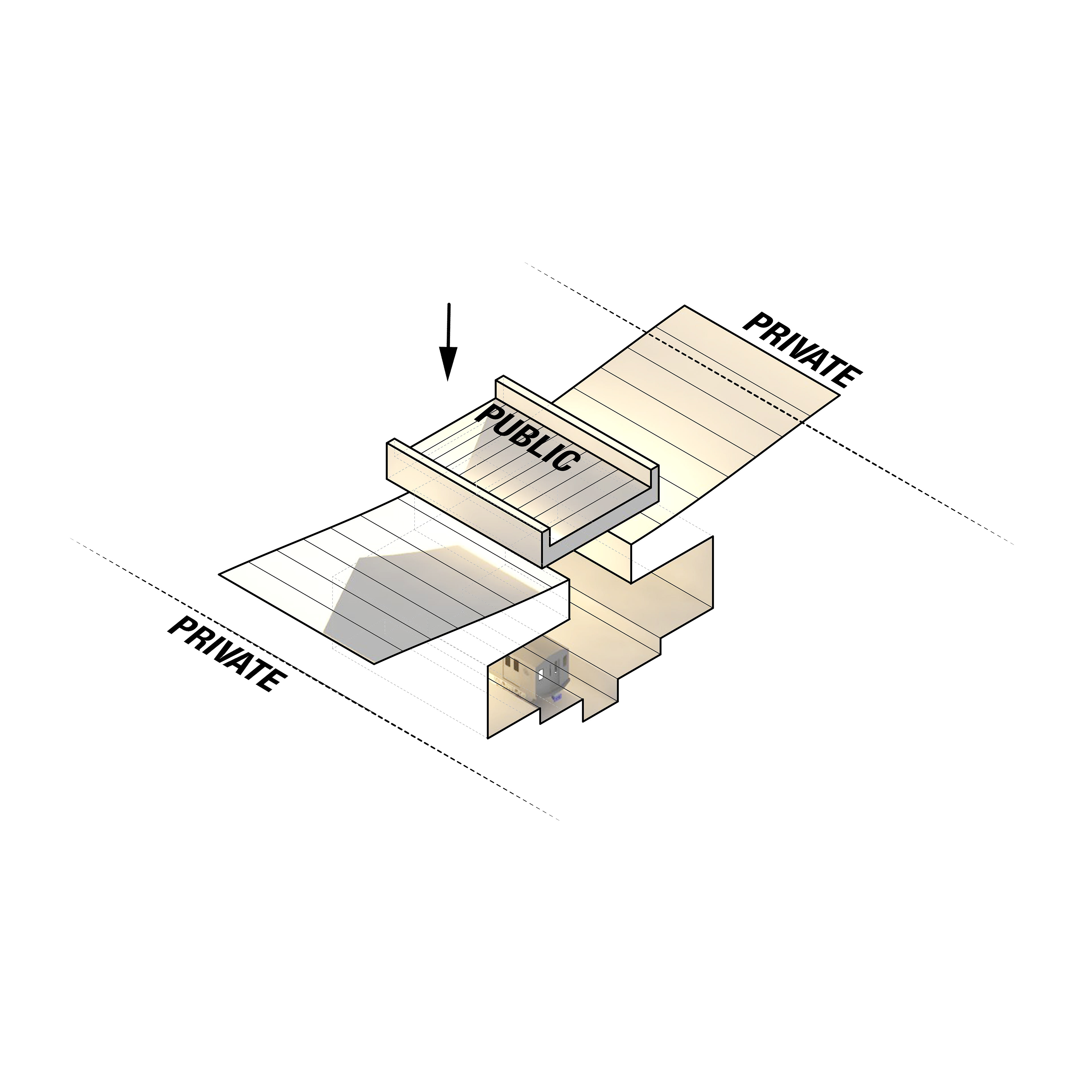
When the public program did interfered, however, the private would always find a way to adapt, whether it was through bridging, mending, or binding.


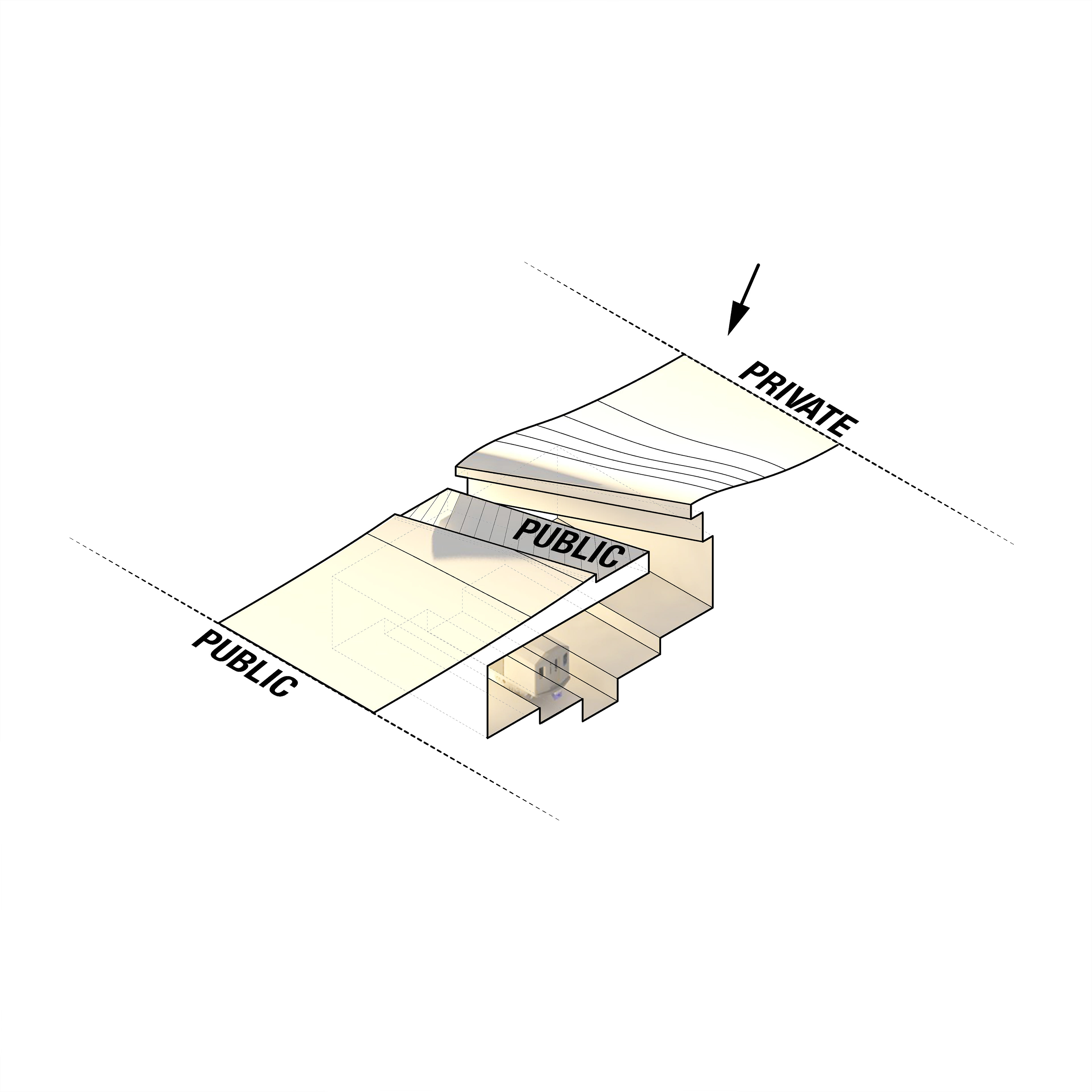
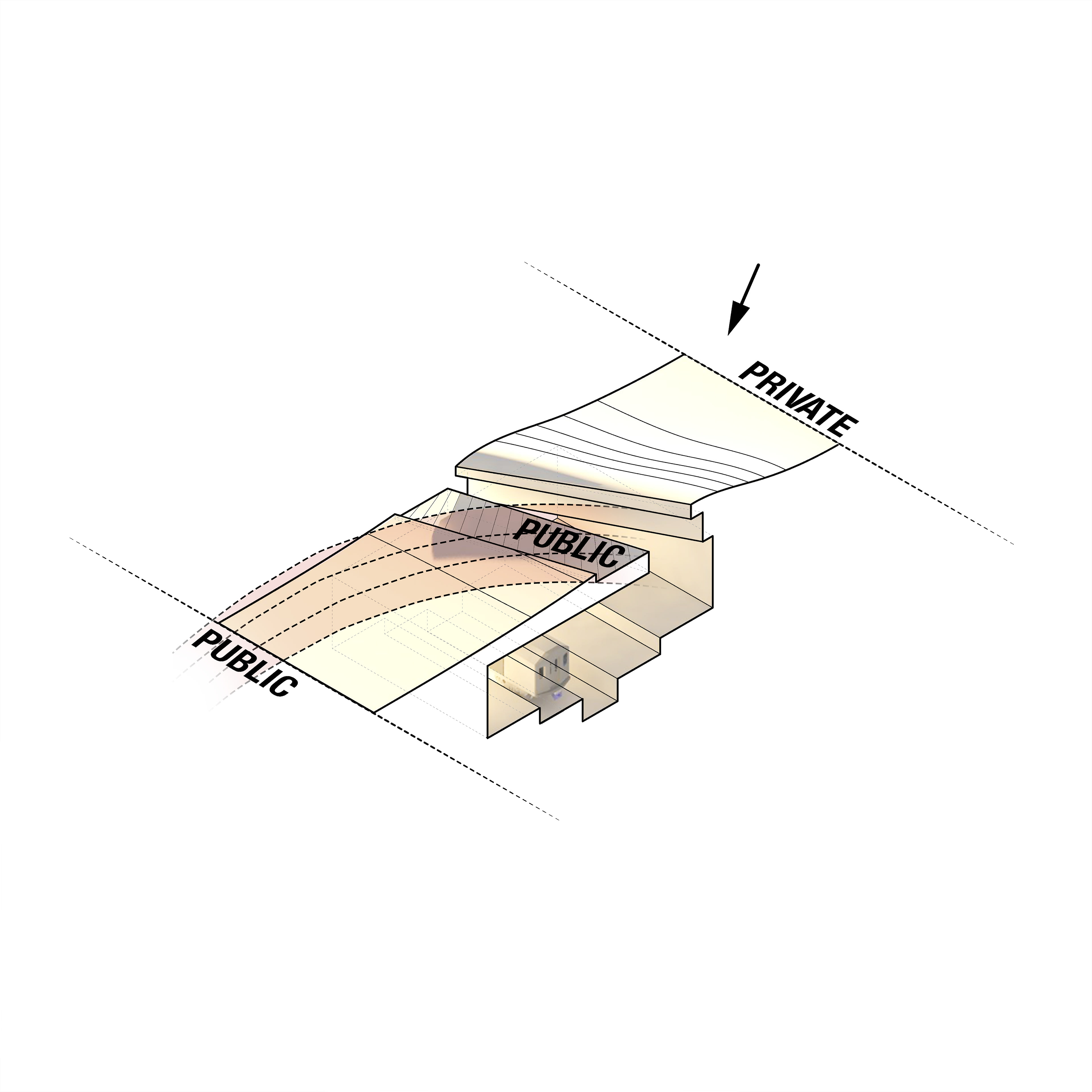
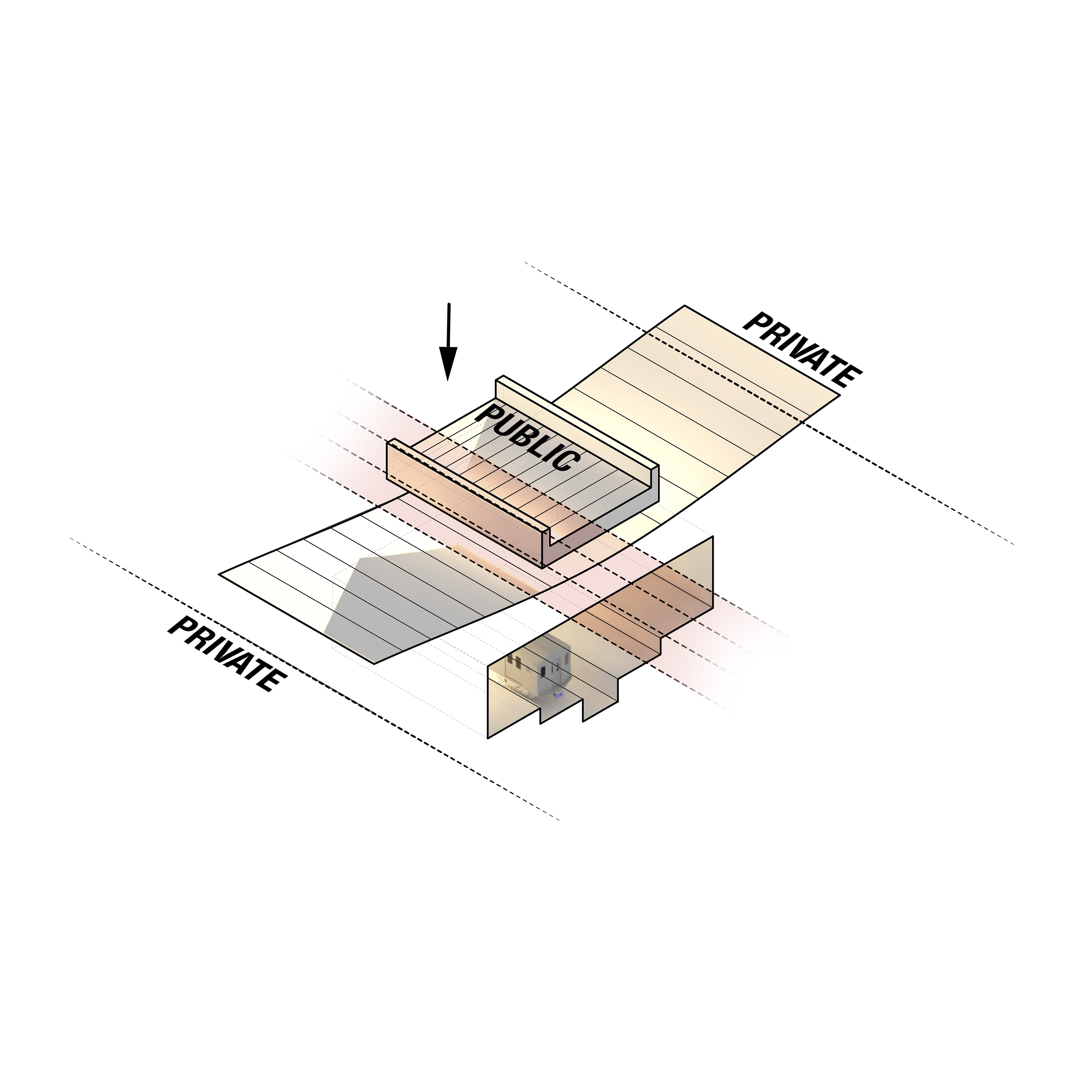
Site Application
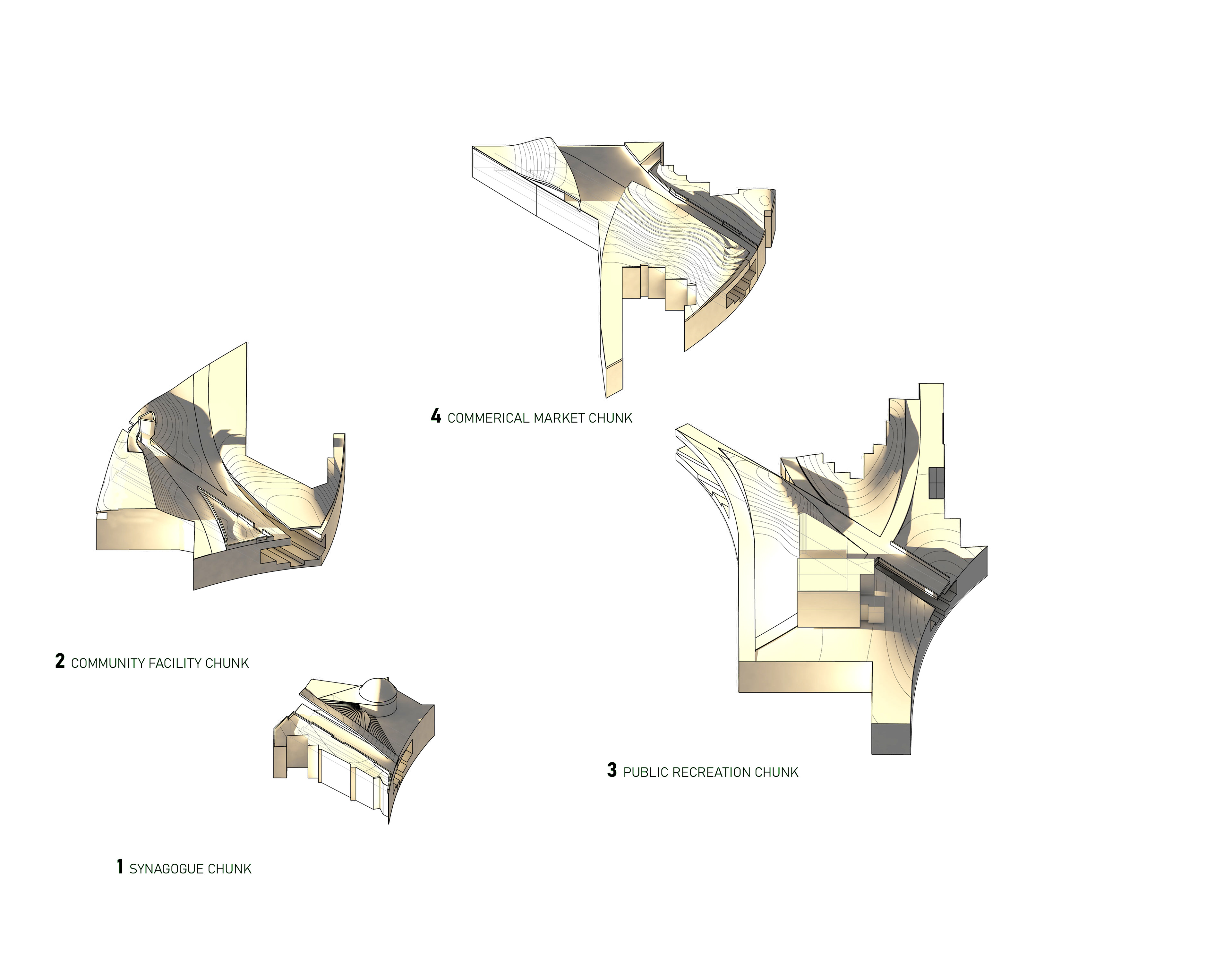
These crafted kit of parts became a toolset for formal activation of the site. One could trigger a social reaction by suggesting an encounter between the public and private pathways.
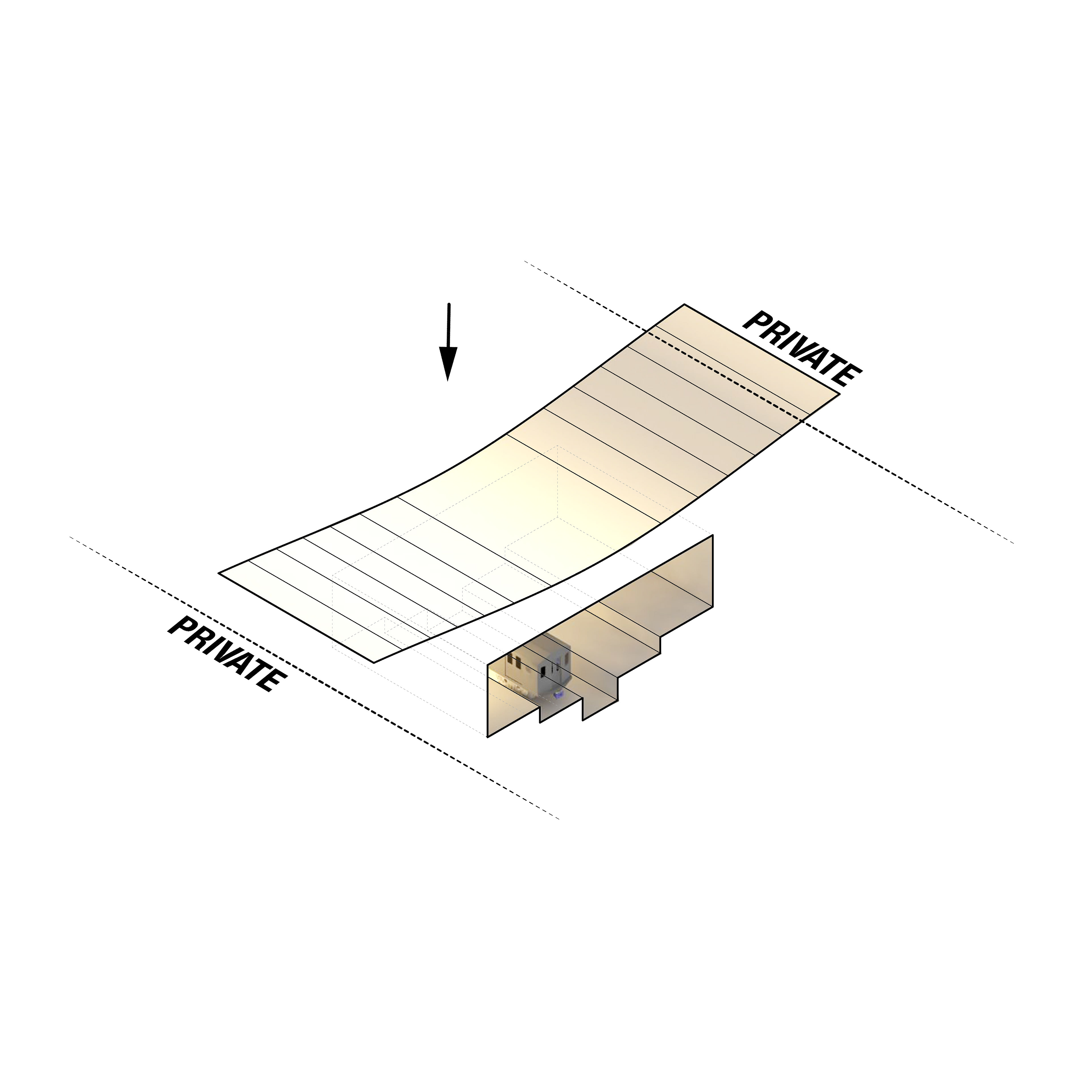
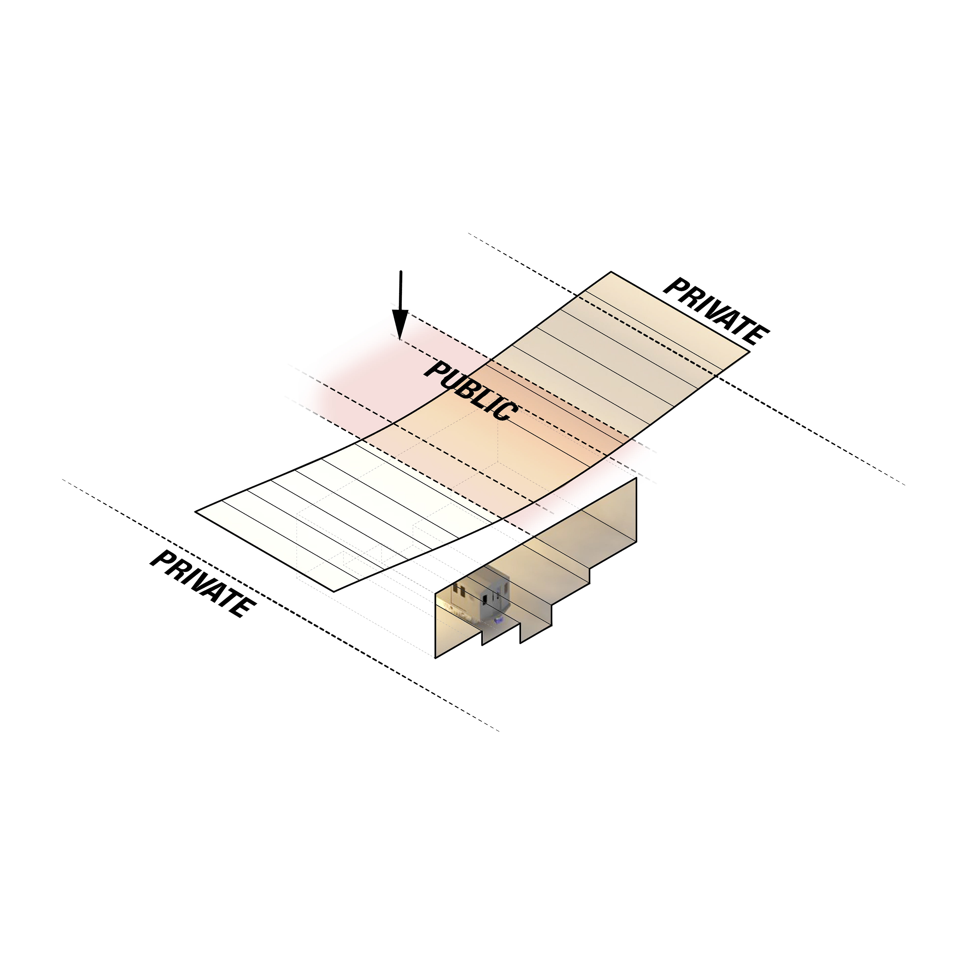
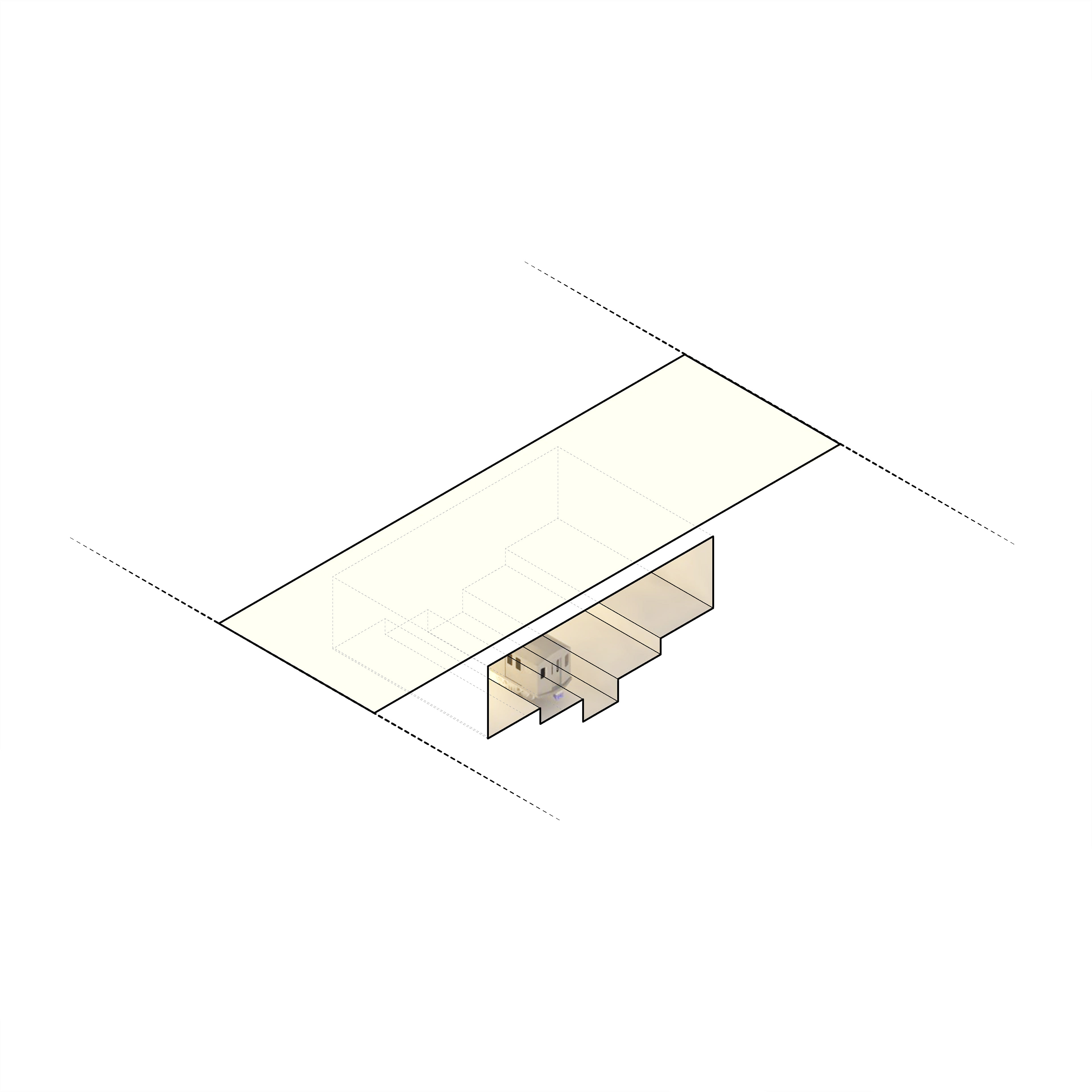
EXISTING CONDITIONS
RAIL WITH SURFACED LANDSCAPE

PUBLIC WALKWAY AND BIKE LANE
PRIVATE PATHS
The main public circulation line, the bike lane, would begin this chain reaction. By meandering the private paths, the community could slowly access the site by choice, mending the datums of the urban fabric.
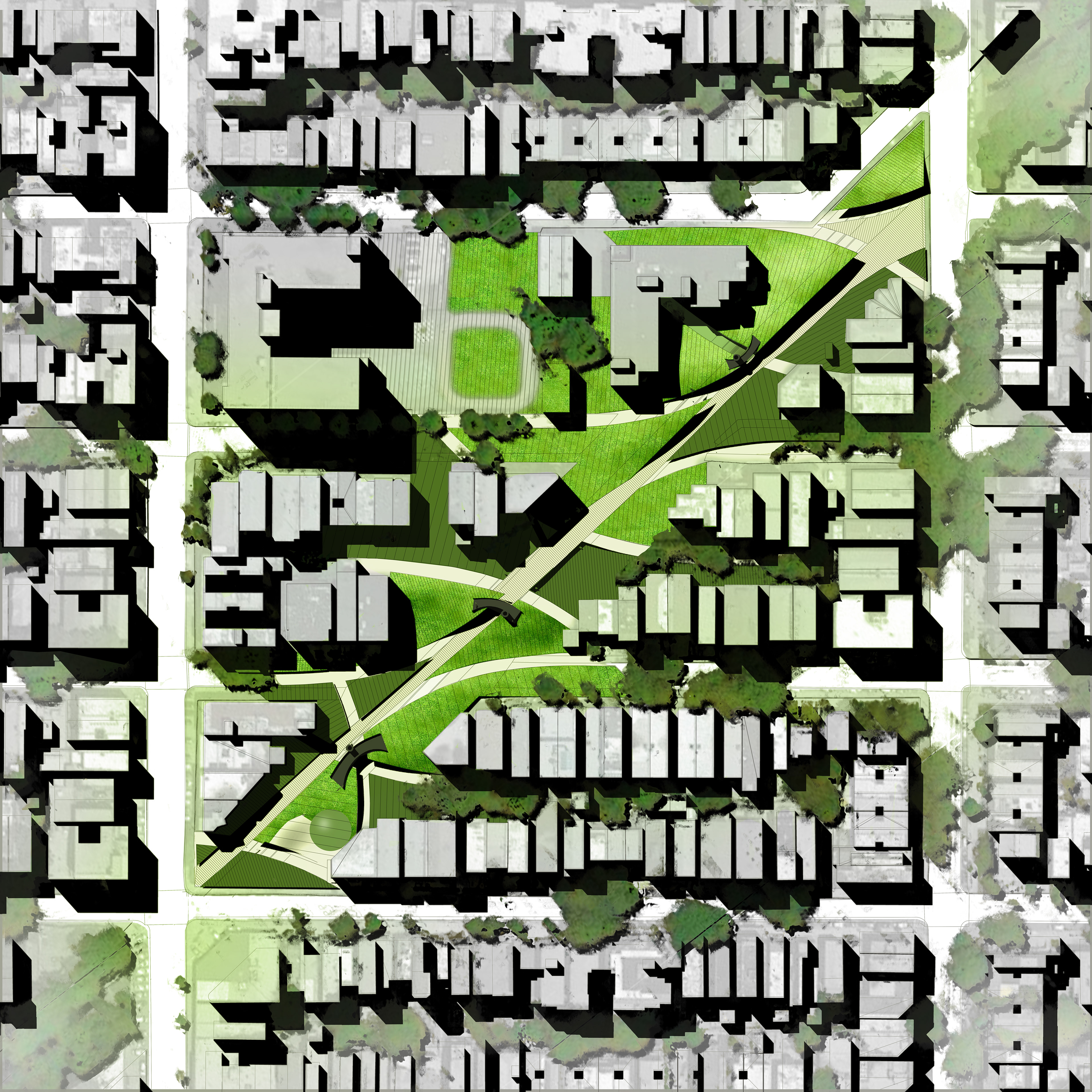
URBANeSCAPE is the resulting arrangement, an assemblage of shapes carved out to display the needs of the community and its surrounding patrons.


An entity, when needed, that could flourish from the ruins of any portion of the abandoned railway.